
Modeling the causes and consequences of land-use change
Two papers, written by Gratton lab members, were recently accepted. Both are modeling papers that use GIS to examine the causes and consequences of land-use change.
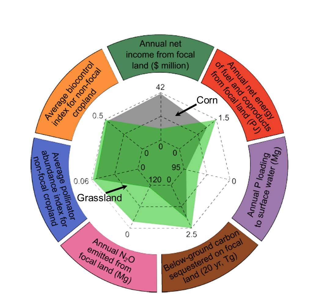 In Tim and Claudio’s paper, they model tradeoffs of multiple ecosystem services (e.g., carbon sequestration, nitrous oxide emissions, pest control, and pollination) from converting annual cropping systems to perennial energy crops (“Ecosystem-service tradeoffs associated with switching from annual to perennial energy crops in riparian zones of the US Midwest”- T. D. Meehan, C. Gratton, E. Diehl, N. D. Hunt, D. F. Mooney, S. J. Ventura, B. L. Barham, and R. D. Jackson). In general, they found that switching from continuous corn to perennial systems incurred a cost (decreased annual income) but the benefits of switching included increased annual energy provisioning, decreased annual phosphorous loading to surface water, increased below-ground carbon sequestration, decreased annual nitrous oxide emissions, increased pollinator abundance and increased pest control potential. The “benefit-cost ratios” varied spatially and by watersheds, suggesting the presence of hotspots “where increases in multiple ecosystem services would come at lower-than-average opportunity costs”. The authors discuss the challenges of expanding to perennial energy crops systems and maintaining sustainable agricultural landscapes.
 In Amin’s paper, he compares different modeling techniques to accurately describe and predict the boundary and shape of urban expansion (“Predicting the expansion of an urban boundary using spatial logistic regression and hybrid raster–vector routines with remote sensing and GIS”- A. Tayyebi, P.C. Perry and A. H. Tayyebi). He examines how biophysical factors (e.g. distance to streams, urban areas, and roads, elevation, slope) influence the rate at which urban boundaries expand over time. He used satellite images of Las Vegas, NV, collected in 1990, 2000, and 2010 to build, test, and validate the models. He discusses how these techniques can be used to plan for future urban boundary expansions in other locations.
Comments are closed.